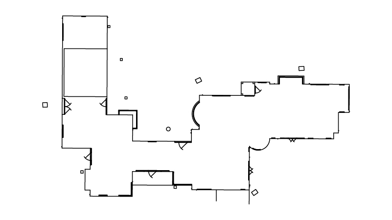
We will survey all accessible floors in the property and provide plans showing all visible walls, windows, doors, spot height levels, ceiling/roof heights, window sill/head heights.
Enter your details
Select Your Address
Select Your Services
Yes – This includes all plan types (i.e. floor, elevations, roof, sections).
No
-

-

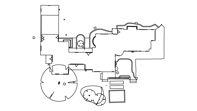
We will survey all accessible and visible sides of the property and provide elevation drawings showing the building outline, ridge/eaves heights, all external distinguishing elements such as windows, doors, rainwater pipes and other detailing. We will also include the outline of buildings within 3m of the host building.
-

Provided where our equipment has full visibility of the roof lines from ground level, we will note any estimated roof details on our drawings.
-

These are 'cut-through' cross-sectional drawings showing wall and floor details.
-
None
-
Basic
-
Mid
-
Full
None Selected
Select a topographical survey level to find out more.
Basic Topographical Survey
Will include the visible boundary outline only together with immediate ground levels around any buildings, and visible drainage cover location/levels.
Mid-level Topographical Survey
This topo will include the visible boundary outline, all key features and immediate ground levels within 3m of any buildings, and visible drainage cover location/levels.
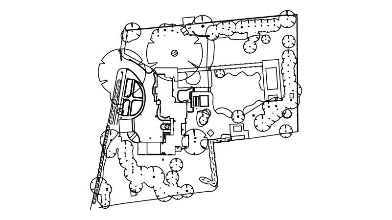
Full Topographical Survey
Will include boundaries (including type and heights), building OUTLINES, adjoining buildings, trees, hardstanding, walls, fences, hedges, flowerbeds, kerblines, verges, manhole / service covers (including cover level), etc. plus all other visible salient features of the area.
Your Estimate
- Total £999.99
We use Area data from your property's EPC certificate and the UK Ordnance Survey database to calculate your quote estimate. If there is not enough data in the UK database we cannot provide an instant quote, but one of our team will be able to provide a formal written quote by email within 48 working hours. If the database holds incorrect data on your property you will still be provided an estimate, but our fee is subject to change to suit the actual size of your property
Your chosen outputs:
(m2) Property Area
(m2) Site Area
If additional services or outputs are required during the delivery stage, additional fees will be added to your final bill as per our T&Cs here
- Why choose us?
- Book a survey within 48hrs
- Fast turnaround on drawing output
- Pinpoint accuracy
- Ranked 5 stars on Google
"I have found incredible flexibility and helpfulness in the XP Surveys team. In my last 10 professional years, I have rarely found a business, surveyors or otherwise, to be as useful, approachable and competitive as them. It helps provide confidence to myself and my clients alike."

Ryan Godfrey
Director and Founder at Elements ArchitecturalWe’ll be in touch shortly!
A member of the XP Surveys team will be in touch shortly
Request a callback
Or call 0333 335 5085
Quote unavailable, but...
Or call 0333 335 5085
Optional
Optional
Or call 0333 335 5085
Sorry, bear with us!
We couldn't find enough data on your property to provide an accurate quote at present, however we will be in touch shortly.